
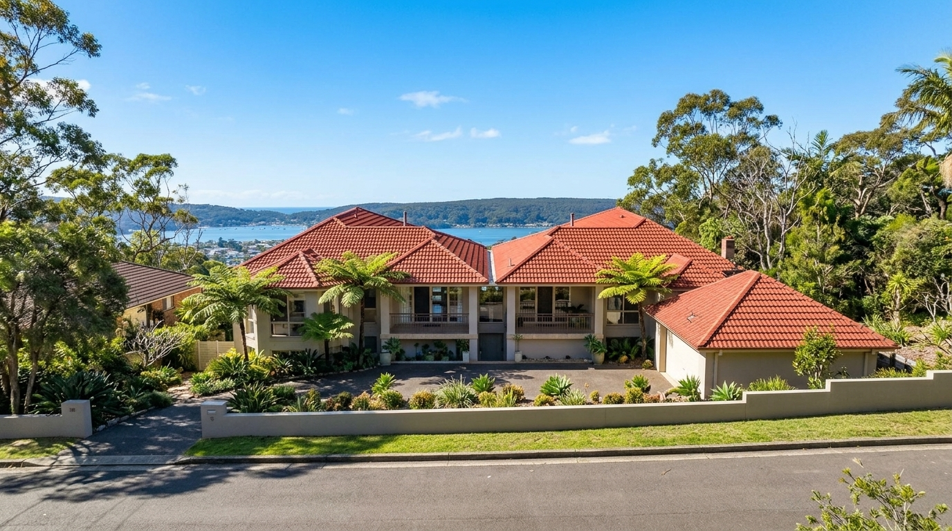
Blackwall sits on the western shore of Brisbane Water, a compact 1.2 km² suburb where the arched silhouette of the Rip Bridge meets the bushland ridgeline of Blackwall Mountain. The water, the boats, the walking trails, the quiet grid of tree-lined streets. None of it screams commuter hub. But the transport network is more connected than it first appears. Buses run through the suburb, a major train station is five minutes away, a ferry departs from nearby Ettalong, and the M1 opens up road trips north to Newcastle or south to Sydney.
Bus Services: The Everyday Workhorse
If you live in Blackwall, the bus is your front-line connection to the rest of the peninsula. Busways runs several routes through the suburb, and the stops are distributed across the street grid rather than clustered on a single road. Most residents are within a short walk of a stop.
Route 53 is the peninsula circulator (the Woy Woy to Booker Bay Loop), running roughly every 20 to 30 minutes. It stops at Springwood Street, Gallipoli Avenue, Commonwealth Avenue, Blackwall Road, and Orange Grove Road at Uralla Lane. If you are heading to Woy Woy Station, the shops at Deepwater Plaza, or just need to get across the peninsula, this is the one.
Route 70 runs hourly from Ettalong Beach to Gosford via Point Clare, Tascott, and Woy Woy. It opens up the broader Central Coast for work or appointments without needing to drive. Routes 71 and 72 add extra frequency on the Ettalong to Woy Woy corridor, handy when the 53 timetable does not quite align with your train.
For the wider peninsula, routes 59 and 64 link Wagstaffe to Woy Woy and Woy Woy to Gosford via Empire Bay and Kincumber. They are less frequent but connect the quieter pockets.
A typical bus trip from Blackwall to Woy Woy Station takes around 6 to 11 minutes. It is short, practical, and runs throughout the day.
Woy Woy Station: The Sydney Commuter’s Lifeline
Woy Woy Station sits about 3 kilometres north of Blackwall, a five-minute drive or quick bus ride. It is one of the Central Coast’s busiest rail interchange points and the reason a Sydney commute is feasible from here.
The station sits on the T1 Central Coast and Newcastle Line, putting Sydney Central roughly 70 to 80 minutes away. Newcastle is a similar distance north. During peak periods, trains run approximately every 20 minutes. You do not need to plan around a single departure. The commute is a commitment, but it is a single-seat train ride on a well-established line: you board at Woy Woy and stay on until Central without a change of train.
For drivers, the commuter car park at Woy Woy has been expanded under the Urban Congestion Fund: a new site on Railway Street with a shared footpath, street lighting, and CCTV. The station also functions as the peninsula’s bus interchange, so it is the transfer point for anyone mixing bus and rail.
Is a Sydney CBD commute a long one? Yes. But 27.7% of Blackwall residents worked from home in 2021, and hybrid work has grown since. Three days on the train, two at the kitchen table is the emerging pattern for peninsula households.
The State Government’s confidence in the corridor is also clear. In April 2024, Woy Woy was added to the NSW Transport Oriented Development SEPP, permitting higher-density housing within 400 metres of the station, a long-term signal that this rail line is a growth spine, not a backwater.
Ferry Services: The Scenic Option
Blackwall does not have a ferry wharf of its own, but two services operate within easy reach.
Central Coast Ferries run from Woy Woy Wharf to Davistown, Saratoga, and Empire Bay, a relaxed way to reach communities across Brisbane Water. If you are visiting friends on the other side of the water or want a Sunday outing, it is a pleasant option.
The better-known service is the Palm Beach Ferry from Ettalong Beach, about 2 kilometres south-east of Blackwall. The crossing takes 30 minutes and connects the Central Coast to Sydney’s Northern Beaches. An adult one-way fare sits at around $15.10. It is not priced as an everyday commute, but as a scenic day trip it is hard to beat.
Ettalong’s ferry terminal is a short drive or bus ride from Blackwall. Catch an early Saturday service, explore the Northern Beaches, and catch the last ferry back.
Road Access and Driving
For all the public transport on offer, this remains a car-oriented peninsula. Blackwall Road and Orange Grove Road form the internal arterial spine, feeding north into Brisbane Water Drive and south toward the Rip Bridge and Daleys Point.
The M1 Pacific Motorway is accessible within about 12 minutes. From there, Sydney CBD is roughly an hour and 20 minutes by car, Newcastle about an hour and 25 minutes. Gosford is a simpler 15-minute drive south along Brisbane Water Drive.
The NSW Government is investing $19 million in Blackwall Road intersection upgrades, delivering dedicated turn lanes, pedestrian-activated traffic lights, a left-turn bay from Blackwall Road to Allfield Road, and new footpaths with pram ramps. The corridor handles roughly 18,000 to 22,000 vehicles a day. Night works continue through mid-to-late 2026, but the end result will be a safer, more efficient route with improved pedestrian and cyclist facilities.
Walking, Cycling, and Active Transport
Blackwall is not a purpose-built cycling suburb. The Walk Score for Woy Woy is 46, firmly in car-dependent territory, and most errands involve a short drive. But the recreational options are genuinely good.
Blackwall Mountain Reserve, also known as Kitchener Reserve, offers bushland walking trails and two lookouts with sweeping views over Brisbane Water, Ettalong, Lion Island, and Barrenjoey Head. A morning walk up the service trail from Bay View Crescent will not get you to the shops, but the views from the top are worth the climb.
The Blackwall Foreshore Walk runs as a shared pathway along the waterfront, linking into the broader Central Coast shared pathway network, including the Woy Woy waterfront through to Macmasters Road, and Ettalong to Ocean Beach. The Brisbane Water foreshore along Orange Grove Road offers waterside walking with views across the estuary, and it is a popular route for residents enjoying the suburb’s natural setting.
At 3 kilometres, Woy Woy Station is a manageable bike ride. The Blackwall Road upgrades include improved pedestrian and cyclist facilities, so the connection is being strengthened for those who want the active option.
Getting Around Blackwall: The Overall Picture
Blackwall’s transport mix is modest, functional, and set within a strong natural landscape. Buses connect the neighbourhood at street level. Woy Woy Station connects the region and makes Sydney reachable. Ferries add a lifestyle dimension few suburbs can match. And the road network opens up the whole Central Coast.
This is not a place for someone who wants a train station at the end of their street. It rewards those who value a quiet, waterside setting and are comfortable with a short drive or bus ride to reach the services they need. For a suburb of fewer than 2,000 people on 1.2 square kilometres, the options cover more ground than the population would suggest.
Frequently Asked Questions
What bus routes serve Blackwall, and how frequent are they?
Route 53 runs every 20 to 30 minutes on the Woy Woy to Booker Bay loop, with stops at Springwood Street, Gallipoli Avenue, Commonwealth Avenue, Blackwall Road, and Orange Grove Road. Route 70 runs hourly from Ettalong Beach to Gosford. Routes 71 and 72 add extra Ettalong-Woy Woy frequency; routes 59 and 64 serve Wagstaffe, Empire Bay, and Kincumber.
How long does it take to commute from Blackwall to Sydney by public transport?
Plan for 90 to 100 minutes door to door. The bus to Woy Woy Station takes 6 to 11 minutes, and the direct train to Sydney Central takes 70 to 80 minutes. It is a single-seat train ride with no changes required. Trains run every 20 minutes in peak periods. With many residents working hybrid schedules, most are not making the trip five days a week.
Where is the nearest train station to Blackwall?
Woy Woy Station is about 3 kilometres north, a five-minute drive or short bus ride. It sits on the T1 Central Coast and Newcastle Line, has a recently expanded commuter car park with new footpath, lighting, and CCTV, and is one of the Central Coast’s busiest rail interchange points.
Is there a ferry service near Blackwall?
Two services are within easy reach. Central Coast Ferries run from Woy Woy Wharf to Davistown, Saratoga, and Empire Bay. The Palm Beach Ferry from Ettalong Beach, about 2 kilometres away, crosses to Palm Beach in 30 minutes. An adult one-way fare is around $15.10. Both wharves are a short drive or bus ride from Blackwall.
Can you live in Blackwall without a car?
It is possible but requires planning. Bus routes connect Blackwall to Woy Woy Station, shops, and services. Most daily errands and school runs benefit from having a car. The Walk Score of 46 for Woy Woy reflects the peninsula’s car dependency. Many households use the bus and train for commuting and the car for everything else.
How long does it take to drive from Blackwall to Sydney or Newcastle?
The M1 is about 12 minutes away via Woy Woy. Sydney CBD takes roughly an hour and 20 minutes by car, Newcastle about an hour and 25 minutes. Gosford is around 15 minutes south along Brisbane Water Drive.
Are there any improvements planned for transport near Blackwall?
A $19 million Blackwall Road intersection upgrade is adding turn lanes, pedestrian lights, footpaths, and pram ramps. The Woy Woy Station car park has been expanded. In April 2024, Woy Woy was added to the Transport Oriented Development SEPP, signalling long-term confidence in the rail corridor.
What is the closest major shopping centre to Blackwall by public transport?
Deepwater Plaza in Woy Woy has Coles, Woolworths, Kmart, and specialty stores. A bus from Blackwall reaches Woy Woy’s shops in under 10 minutes. The station and shops are clustered together, so a single bus trip covers both the train and the grocery run.
Are there walking and cycling paths in Blackwall?
Blackwall Mountain Reserve has bushland walking trails and two lookouts with Brisbane Water views. The Blackwall Foreshore Walk is a shared pathway along the waterfront, linking into the Central Coast shared pathway network. The Brisbane Water foreshore along Orange Grove Road offers scenic waterside walking. The Blackwall Road upgrades are adding improved pedestrian and cyclist facilities. Recreational walking is well catered for.
How do I get from Blackwall to Ettalong Beach or Umina Beach without a car?
Bus routes 70, 71, and 72 connect Blackwall to Ettalong Beach directly. Ettalong is roughly 2 kilometres away and Umina Beach about 5 kilometres, reachable by bus with a connection. Once at Ettalong, the Palm Beach Ferry is another option for a day trip to the Northern Beaches.